|
Note: All directions are given FROM OCONOMOWOC
|
|
|
|
Click here for directions to Roosevelt Field
|
|
|
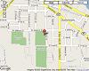
View Google Map
Driving Directions
|
|
|
Brookfield
(McCoy Park)
|
Take Hwy 16 East to Capital Drive (Hwy 190)
Go East on Capital Drive
Follow Capital Drive until you get to Brookfield Rd
Take a right on Brookfield Rd
Take your 3rd right (there should be a sign saying McCoy Field Park)
Field is on the left
|
|
|
|
View Google Map
Driving Directions
|
|
|
Brownsville
|
Take Hwy 67 North out of Oconomowoc for around 30-40 minutes to Mayville
Continue on Hwy 67 North through Mayville
On the north end of Mayville, take Hwy V (branches off to the left)
Stay on Hwy V for another 20-30 minutes until you come to Hwy 49
Take a right on Hwy 49 (East) and that will take you into Brownsville
Take a right on Prospect Ave and the field will just up ahead
|
|
|
|
View Google Map
Driving Directions
|
|
|
Butler
(Frontier Park)
|
Take Hwy 16 East to Capital Drive (Hwy 190)
Go East on Capital Drive
Follow Capital Drive until you get to Lilly Rd
Take a left (north) on Lilly Rd and follow it until you come to Silver Spring Dr (VV)
Turn right (east) on Silver Spring Dr and follow it to Park Dr.
Take a right (south) on Park Dr and it will run into the field
|
|
|
|
View Google Map
Driving Directions
|
|
|
Cedarburg
(Behling Field)
|
Take Hwy 67 or Hwy P North until you hit Hwy 60
Turn right (east) on Hwy 60. This will take you through Hartford.
Stay on Hwy 60 for roughly 20 miles until you get close to Cedarburg.
Take a right (south) on Hwy 181 / Hwy 143 (Washington Ave).
Stay on Washington Ave (Hwy 143) and go until you come to Columbia Rd.
Take a left (east) on Columbia Rd and then take an immediate right onto Portland Rd.
Field will be on your right.
|
|
|
|
|
|
|
|
Clyman
|
Take Hwy 67 or Hwy P North until you hit Hwy 60
Take a left on Hwy 60 (West)
Take a left (South) on County Road M (if you get to Hwy 26, you went too far)
Take a right (West) County Road J
This will take you into Clyman. Take a left on Morgan St and the field will be on your right
|
|
|
|
View Google Map
Driving Directions
|
|
|
Hartford
|
Take Hwy 67 or Hwy P North until you hit Hwy 60
Turn right on Hwy 60. This will take you right into Hartford
Stay on that road and drive through Hartford. The field will eventually be on your left (right next to the leather tanning factory)
|
|
|
|
View Google Map
Driving Directions
|
|
|
Hartland
(Nixon Park)
|
Take Hwy 16 East to the Merton / North Ave exit
Turn right off exit (South). This will take you into Hartland
At the first stop sign, take a left
At the next stop sign, take a right. (A gas station will be on the right hand side)
Baseball field will be up on the right hand side
|
|
|
|
|
|
|
|
Horicon
|
Take Hwy 67 or Hwy P North until you hit Hwy 33
Turn left on Hwy 33. This will take you right into Horicon
Once in Horicon, take a right on N. Finch St.
Stay on this for a couple blocks until you come to a park
Baseball field is to the right of the park.
|
|
|
|
|
|
|
|
Hustisford
|
Take Hwy 67 or Hwy P North until you hit Hwy 60
Take a left on Hwy 60 (West) and go until you see the big Hustisford sign on the right
After the sign, you will see a gas station off the right hand of the road.
Take a right off of Hwy 60 (like you are going to the gas station)
Continue past the gas station and take the third right (Ann St)
Go until you come to a T in the road. Take a right at the T
Shortly after the turn you will see a parking lot up a hill on the right. Baseball field is there
|
|
|
|
|
|
|
|
Johnson Creek
|
Take I-94 West (towards Madison)
Get off on the Johnson Creek exit (Hwy 26. This is the same exit as the outlet mall)
Turn LEFT (South) on Hwy 26 (the opposite direction of the outlet mall)
Take your second right (Milwaukee St)
Follow this for a half mile or so until you go under a railroad track bridge
There is a stop sign just under the bridge. Take a right at the stop sign (Union St)
Baseball field will be up on your right
|
|
|
|
|
|
|
|
Juneau
|
Take Hwy 67 or Hwy P North until you hit Hwy 60
Take a left on Hwy 60 (West) for about 5-10 miles until you get to Hwy DJ.
Take a right on Hwy DJ. Follow it for about 5-10 miles and it will take you right into Juneau.
Once in Juneau take a left on Mill St. Field will be up on the right.
|
|
|
|
View Google Map
Driving Directions
|
|
|
Lannon
(Joekes Field)
|
Take Hwy 16 East to the Ryan St exit
Turn left on Ryan St (North)
Take a right on Hwy JK
The road will curve to the left and eventually come to a stop sign, take a right (Hwy K)
Follow Hwy K until you come to Hwy 74.
Take a left (North) on Hwy 74.
This will take you into Sussex, eventually to a 4-way stop (Hardees on your right). Take a right at the 4-way stop (Main St)
Eventually you will come to a stop sign where you must turn left or right. Take a left (under the graffiti bridge)
This road will curve to the right and take you into Lannon.
At the first stop sign you come to, take a left (Lannon Road) (a bar called Mibbs and Vibbs is at the intersection)
The field is about 1/4 mile down on the right.
|
|
|
|
View Google Map
Driving Directions
|
|
|
Lebanon
(Firemans Park)
|
Take Hwy 16 West twords Watertown
Before you get to Watertown, take a right (north) on Hwy SC
Hwy SC will eventually hit County Road R. Take a right on R (109)
Field will be up on the left (Firemans Park)
|
|
|
|
|
|
|
|
Mayville
(Firemans Park)
|
Take Hwy 67 North out of Oconomowoc for around 30-40 minutes to Mayville
In Mayville, take a right on Bridge St (first right past stop lights)
Turn right on German St
Go straight to the top of the hill and turn right on Park St
|
|
|
|
View Google Map
Driving Directions
|
|
|
Menomonee Falls
(Riverside Park)
|
Take Hwy 16 East to Capital Drive (Hwy 190)
Go East on Capital Drive
Stay on Capital Drive for roughly 10-15 miles until you get to Pilgrim Road (there is a mini mall on the left just before Pilgrim Road)
Take a left on Pilgrim Road
Stay on Pilgrim Road for a while and this will take you right into Menomonee Falls
The field will eventually be on the right hand side of Pilgrim Road
|
|
|
|
View Google Map
Driving Directions
|
|
|
Merton
(Firemans Park)
|
Take Hwy 16 East to the Jungbluth Rd exit
Turn left off exit (North)
Follow this road until you come to a T in the road where you must go left or right
Turn right at the T and then take an immediate left on County Rd KE
This will take you into Merton. Once in Merton, there will be a sign on the left hand side that says "Firemans Park"
Turn left into Firemans Park and the baseball field in up ahead
|
|
|
|
View Google Map
Driving Directions
|
|
|
Monches
|
Take Hwy 16 East to the Hwy 83 exit
Turn left off Hwy 83 (North)
Follow windy road for 10 miles or so all the way into North Lake
Once in North Lake, you will see a gas station on your right
Turn right (East) immediately after that gas station (County Rd VV)
Follow VV until you see County Rd E
Take a left (North) on County Rd E
Baseball field is off County Rd E on the left
|
|
|
|
|
|
|
|
Neosho
|
Take Hwy 67 North. This will take you right into Neosho
Once in Neosho you will go over a small bridge. Take the first left after that bridge (W. Lehman St)
The field will be just up that road
|
|
|
|
View Google Map
Driving Directions
|
|
|
New Berlin
(John J Malone Park)
|
Take Hwy 16 East to I-94 East (or just get on I-94 East from Oconomowoc)
Get off on the Moorland Rd exit. Take a right onto Moorland Rd (South)
Go a couple miles until you hit National Ave.
Take a right on National Ave (West) and the field will be about a 1/2 mile up on your right.
|
|
|
|
View Google Map
Driving Directions
|
|
|
North Lake
(Firemans Park)
|
Take Hwy 16 East to the Hwy 83 exit
Turn left off Hwy 83 (North)
Follow windy road for 10 miles or so all the way into North Lake
Once in North Lake, take a right on Park St (if you get to the gas station on the right, you went too far)
Baseball field is on Park St
|
|
|
|
|
|
|
|
Pardeeville
(Chandler Park)
|
Take Hwy 16 West twords Watertown
Follow Hwy 16 through Watertown (do not get on Hwy 16 BUSINESS)
Continue on Hwy 16 for about an hour until you come to Hwy 22
Take a right on Hwy 22 (North)
This will take you right into Pardeeville
In downtown Pardeeville, turn right on Hwy 44 (you will see Wild Bill's Saloon on your left)
Take the first left (Chandler Park Dr) and the field is right there (Chandler Park)
|
|
|
|
View Google Map
Driving Directions
|
|
|
Pewaukee
(Pewaukee Village Park)
|
Take Hwy 16 East to the Ryan Rd exit
Turn right on Ryan Rd
In about half a mile you will come to a stop sign. Take a left (W. Wisconsin Ave)
Follow this road for a mile or two and take a left just BEFORE the railroad tracks (High St)
Immediately take a right on Capital Dr (at this point you will be driving along side the railroad tracks)
Baseball field will be up on your left
|
|
|
|
View Google Map
Driving Directions
|
|
|
Racine
(Horlick Field)
|
Take I94 East to 894 South (towards Chicago).
Follow 894 until you come to I94 again and go south (towards Chicago).
Stay on I94 South until you get to exit 329 (Racine County K).
Turn left (east) on Highway K and go until you come to Hwy 38.
Turn right (south) on Hwy 38 to High St.
Turn left (east) on High St. Park is on the right before you get to Memorial Drive.
|
|
|
|
|
|
|
|
Rome
|
Take Hwy 67 (or Hwy BB) south until you come to Hwy 18
Turn right (West) on Hwy 18
When you get to Sullivan, Hwy 18 turns into Main St.
In Sullivan, Hwy 18 branches to the right, STAY on Main St (now Hwy F) and field will eventually come up on your right
|
|
|
|
View Google Map
Driving Directions
|
|
|
Rubicon
|
Take Hwy P North
Cross Hwy 60 and stay on Hwy P
You will shortly run right into Rubicon
Once in Rubicon, take a right on Rome Rd
The field will be up on your left
|
|
|
|
View Google Map
Driving Directions
|
|
|
Slinger
|
Take Hwy 67 or Hwy P North until you hit Hwy 60
Turn right on Hwy 60. This will take you through Hartford
Stay on Hwy 60 through Hartford which will then lead you into Slinger.
Take a left on Slinger Rd and field will be up ahead
|
|
|
|
View Google Map
Driving Directions
|
|
|
Sussex
(Village Park)
|
Take Hwy 16 East to the Ryan Rd exit
Turn left on Ryan Rd (North)
Take a right on Hwy JK
The road will curve to the left and eventually come to a stop sign, take a right (Hwy K)
Take a left at the first set of stop lights you come to (Hwy 164)
Take a right at the first set of stop lights you come to (Main St) (You will see a gas station and McDonalds on your right)
Main St will take you right into Sussex
On the right hand side you will see a sign for "Firemans Park", turn in there
Follow that road for about 1/2 mile and the field will be on the right
|
|
|
|
View Google Map
Driving Directions
|
|
|
Waterford
(Tom Malison Field / Joe Whitford Park)
|
Take Hwy 16 (or I94 East) to the Hwy 83 exit
Go right (South) on Hwy 83
You will be on Hwy 83 for a long time and will eventually take you right into Waterford
stay on Hwy 83 through Waterford until you come to River Rd.
Take a right on River Rd.
Field will come up quickly on the right.
|
|
|
|
|
|
|
|
Watertown
(Washingon Park)
|
Take Hwy 16 West twords Watertown
Hwy 19 will veere to the left off Hwy 16, take it
Take a left on Concord
Take your first right (Western)
Take the 3rd left (S 12th St)
The field will be on your left
|
|
|
|
View Google Map
Driving Directions
|
|
|
West Bend
(Regner Park)
|
Take Hwy P (or Hwy 67) north for roughly 30 minutes until you get to Hwy 33.
Take a right on Hwy 33 (East)
Hwy 33 will eventually lead you right into West Bend.
You will see a Family Video on your left. Take a left just after the Family Video (Silverbrook Dr)
The field will be up on your left.
|
|
|
|

